


The Eretz Yisrael Map
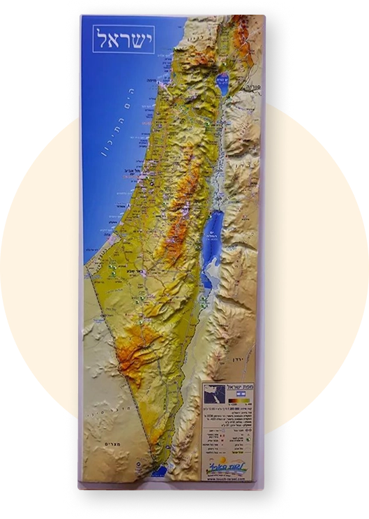
About the Map
This map, developed based on Rabbi Holtzman’s shiurim and approach to learning, opens a new gateway to understanding Tanach.
It transforms learning from text on a page into a living reality unfolding across real mountains, valleys, rivers, and pathways.
The map presents Eretz Yisrael in a way that clearly highlights elevations and valleys, desert expanses alongside settled regions, tribal boundaries, and major routes of travel, thereby connecting traditional yeshiva learning with the physical reality of the Land itself.
Why Is This Map Essential for Learning Tanach?
Many people learn Tanach without visualizing where events actually took place: where is Emek HaElah relative to Yerushalayim, what is the distance between Shiloh and Beit El, how does the Midbar relate to the mountain cities, where does the Yarden flow, what do the tribal borders actually look like
This map is designed to answer precisely these questions.
It helps:
Visualize the
geographic
flow of narratives
and prophecies
Sheds new light
on accounts of wars,
journeys,
and settlement
Deepen understanding of location choices - tribal borders, Mishkan and other key sites